
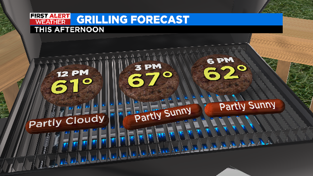
Today is a great day to get out and grill if you’re in North Texas.
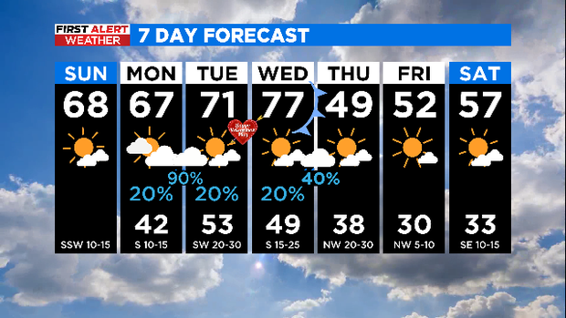
Who’s ready for a super beautiful Sunday?!
We start out cold, in the top 20 in some places with partly cloudy skies. But boy, we’re warming up well this afternoon. Highs in the upper 60s with a mixture of sun and clouds; perfect if you’re grilling for a Super Bowl party.
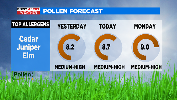
Beware if you are allergic! Today we are in the mid-high range.
Another soft day on the way to Monday. The highs remain above 60, but there will be more cloud cover.
On the night of Monday to Tuesday, rain returns to the area along with several mild storms.
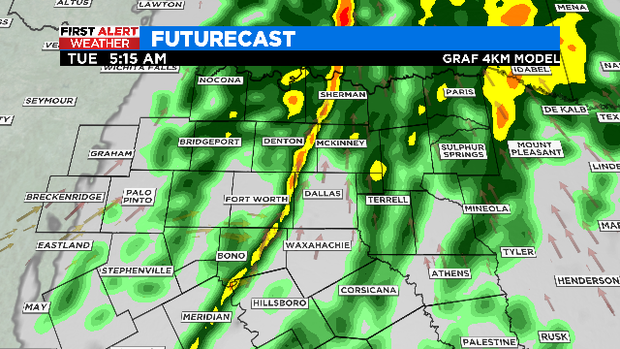
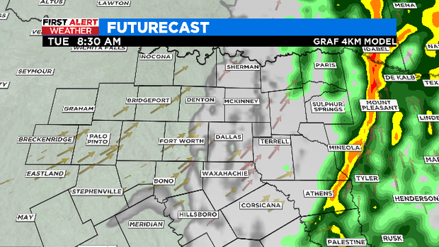
The rain stops by late morning, allowing the clouds to dissipate, and the temperature really reaches 70 degrees!
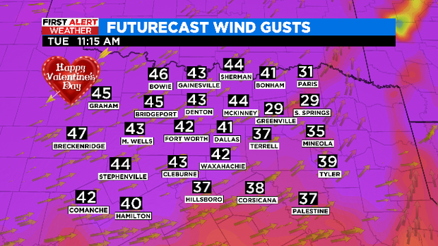
Valentine’s Day will be warm, mostly sunny and very windy! A trash can can drive down the street as the southwest wind blows up to 40-45 miles per hour!
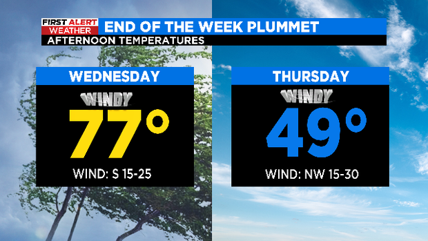
Our moderate temperatures and windy conditions will continue on Wednesday ahead of a strong cold front that will keep Thursday’s highs in the 40s. Pay attention to these strong northwesterly winds. It will be 10 degrees colder during the day!
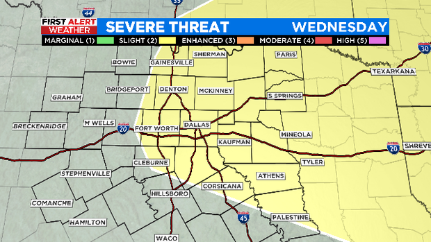
The chance of rain and storm increases as the cold front moves into North Texas. The Storm Prediction Center is already highlighting areas along and east of I-35 for potential severe storms late Wednesday night.
We are returning to cold mornings and cold days to complete the workweek. Luckily, the sun is back too!
SUPER Sunday everyone!
Dallas Press News – Latest News:
Dallas Local News || Fort Worth Local News | Texas State News || Crime and Safety News || National news || Business News || Health News
texasstandard.news contributed to this report.


