
It’s sunny and spring temperatures in North Texas today, but rain will return this week.
FORT WORTH (CBSNewsTexas.com) – Happy Sunday! I hope everyone’s weekend is off to a great start!
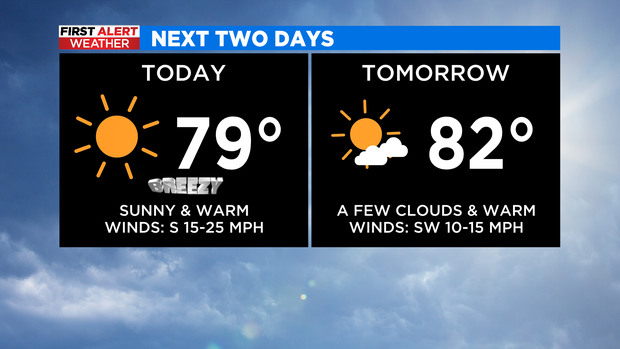
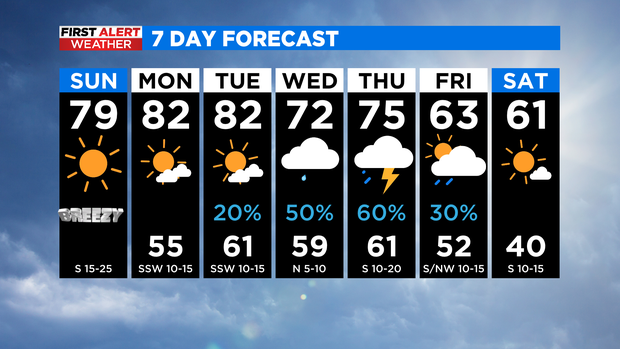
Good news! We have a repeat of Saturday! This means there will be more sunshine again today and highs above the 70s. Puppies will want to soak up the sun like Benji is here! Thanks Stuart!

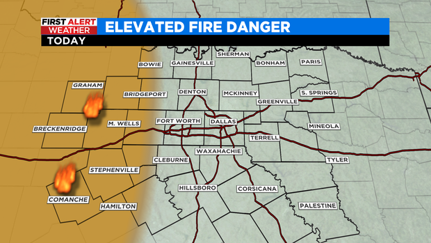
In the afternoon, the wind will be more gusty, up to 30 miles per hour, and as the humidity level drops to about 25% in the west, there will be an increased fire risk in the afternoon.
Monday will be joined by some more clouds but will still be great with sub-80s highs and dry conditions.
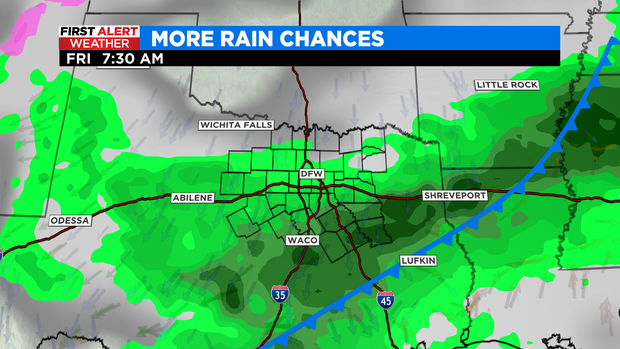
The middle of the week gets a little tricky with the possibility of localized flooding, small hail and gusty winds. The total rainfall, storm strength and temperature depend on the frontal boundary that has stalled in the area.
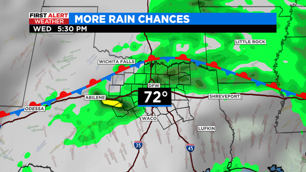
If the front turns south, as NAM suggests, and gets closer to I-20, North Texas will be cooler and likely wetter. The GFS holds the front further north, closer to the Red River, which means less rainfall and warmer temperatures.
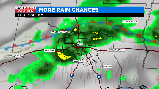
But, as you may have guessed, there is no good model agreement right now. It looks like stronger storms will arrive with the passage of a cold front on Thursday.
Before rain, pollen counts remain HIGH.

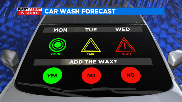
If your car needs a good wash, today and tomorrow are the best times to get it done.
By the end of the week it will get colder, and next week the temperature will drop below normal. If you are taking advantage of our beautiful weather to garden, you may need to cover sensitive vegetation next week.
Have a phenomenal Sunday and see you tomorrow morning!
Dallas Press News – Latest News:
Dallas Local News || Fort Worth Local News | Texas State News || Crime and Safety News || National news || Business News || Health News


