
First Alert Weather Day: Temps continue falling as rain moves east
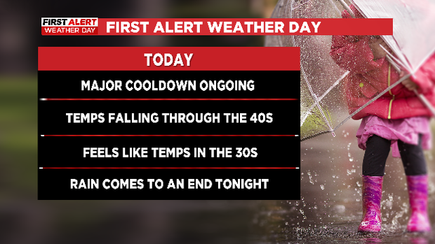
FORT WORTH (CBSDFW.COM) — Our First Alert Weather Day is in full effect – temperatures are falling quickly behind a strong cold front moving through the state, and scattered showers and a few thunderstorms remain possible through the early evening.
CBSDFW.com
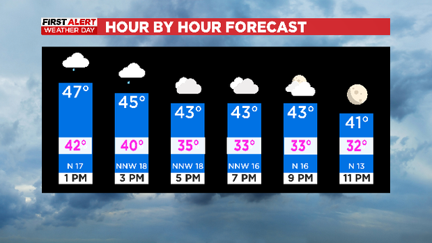
While a few stronger storms have occurred in Central Texas, it’s mainly been heavy rain and some lightning here to the north. Rain chances will continue here at 40-50% coverage through the early evening hours but we should begin to dry out as we get closer to sunset. The skies will eventually clear overnight, and that will lead to a very cold morning to start our weekend.
CBSDFW.com
Speaking of those cold temperatures, as of midday Friday temperatures were already 20-30°F cooler than they were at 12 p.m. on Thursday and we’ve still got brisk north winds driving cooler air farther south. Temperatures will continue to fall through the 40s this afternoon, and wind chill values will be in the 30s for a lot of North Texas. Whether you’re heading to a Veterans Day event, picking the kids up from school, or planning for those Friday night football games, dress for the 30s.
CBSDFW.com
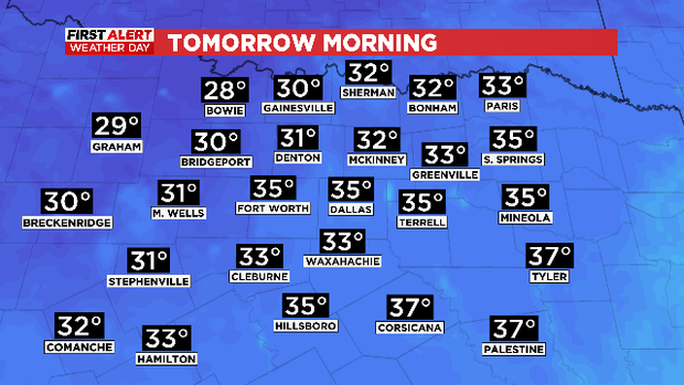
A heads up for Saturday morning! We have a freeze warning for parts of the region from 3 a.m. through 8 a.m. Temperatures are expected at or below freezing, and wind chill values could be in the 20s for some.

CBSDFW.com
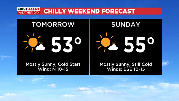
Some sunshine is expected into the weekend though, so the afternoons shouldn’t be quite as cold. Expect highs in the low to mid 50s.
CBSDFW.com
Dallas Press News – Latest News:
Dallas Local News || Fort Worth Local News | Texas State News || Crime and Safety News || National news || Business News || Health News
texasstandard.news contributed to this report.


